Pang Ung and the Route from Chiang Mai to Mae Hong Son
A practical regional guide to lakeside landscapes, community visits, and route planning in western northern Thailand
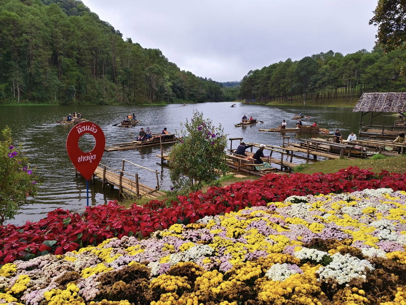
Pang Ung is a highland lake destination in Mueang Mae Hong Son District, Mae Hong Son, known for cool air, forested slopes, and calm water surrounded by mountain scenery. The name is often written in several ways, including Pang Oung, Pangung, and Pang Ung Lake. These variations can be useful when comparing maps and travel information, but they generally refer to the same scenic area near Ban Ruam Thai. For travelers approaching from Chiang Mai, the lake is best understood as one part of a broader regional journey rather than an isolated stop. A route through northern Mae Hong Son can connect mountain roads, local communities, viewpoints, and natural sites over several days. This is why the phrase Chiang Mai To Mae Hong Son Tour Package appears in travel planning discussions: it describes a possible style of organized or customized route, not a single fixed itinerary or guaranteed service. This guide focuses on how Pang Ung fits into that regional flow. It considers the landscape and cultural setting, explains route-planning language, and then connects the lake with Ban Rak Thai and Phu Klon. The aim is to help independent travelers compare options with realistic expectations while approaching local communities respectfully.
The Highland Setting of Pang Ung
Pang Ung lies in the mountainous interior of Mae Hong Son Thailand, in a landscape shaped by steep roads, pine and mixed forest, small settlements, and changing elevations. The lake is a reservoir rather than a large natural inland lake, and its reflective surface is most closely associated with the surrounding woodland and morning mist. Light, cloud, and temperature can alter the appearance of the area considerably, so the visual character is part of the experience rather than a fixed attraction display.
The destination is also linked with Ban Ruam Thai, a community whose local setting gives the lake a human as well as environmental context. Visitors should treat the area as a lived-in highland community, not simply as a photo backdrop. Roads, gardens, farms, public spaces, and forest edges may all have practical importance to residents. Keeping noise low, remaining on appropriate paths, and asking before photographing people or private property are simple ways to support respectful community tourism.
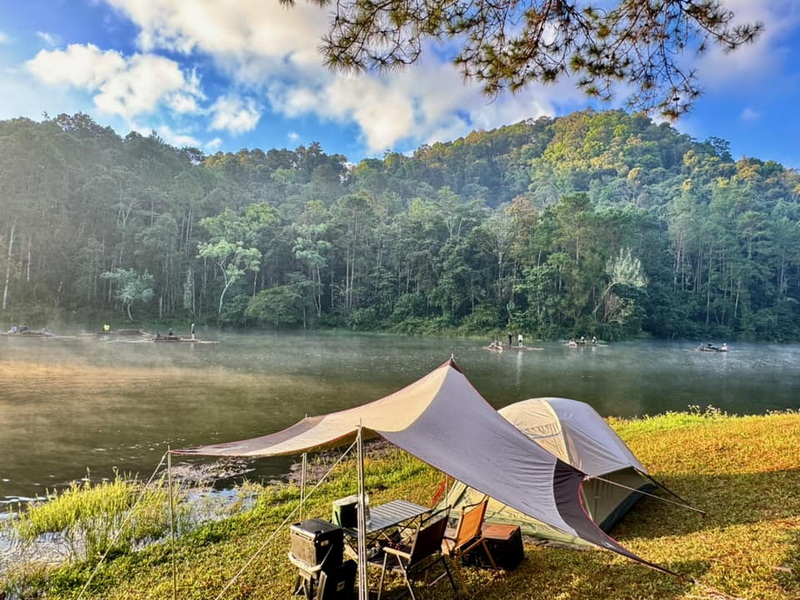
A visit to Pang Ung Mae Hong Son can therefore combine observation of nature with awareness of how people use and care for the highlands. The forested slopes help create the cool atmosphere that draws visitors, while the reservoir and nearby roads form part of a managed landscape. Travelers seeking a Pang Ung Travel Guide should check current local notices before departure because access arrangements, weather conditions, and visitor expectations can change.
Reading Chiang Mai to Mae Hong Son Tour Language
The phrase Chiang Mai To Mae Hong Son Tour Package covers a wide range of possible travel ideas. In general usage, it may refer to a multi-day road journey from Chiang Mai toward Mae Hong Son, a private arrangement using a driver, or an itinerary assembled around selected stops. It does not by itself confirm a provider, price, vehicle type, hotel, or operating schedule. Readers comparing such descriptions should examine the actual route and inclusions rather than relying on the label alone.
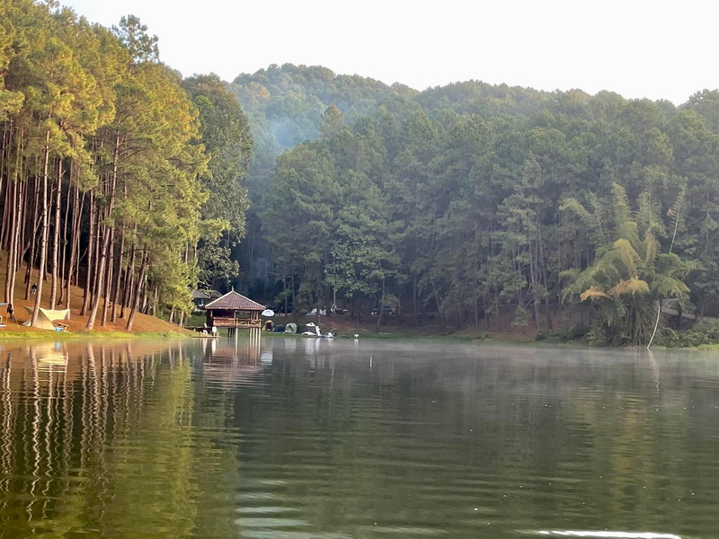
One common overland approach travels west from Chiang Mai through the mountain corridor associated with Pai before continuing toward Mae Hong Son. Another planning approach treats Mae Hong Son as the main base and adds Pang Ung as a regional excursion. The best choice depends on available time, road comfort, weather, and whether the traveler prefers a gradual loop or a more direct regional focus. Pang Ung is not usually a casual city-center stop, so its position on the map should be considered before finalizing a plan.
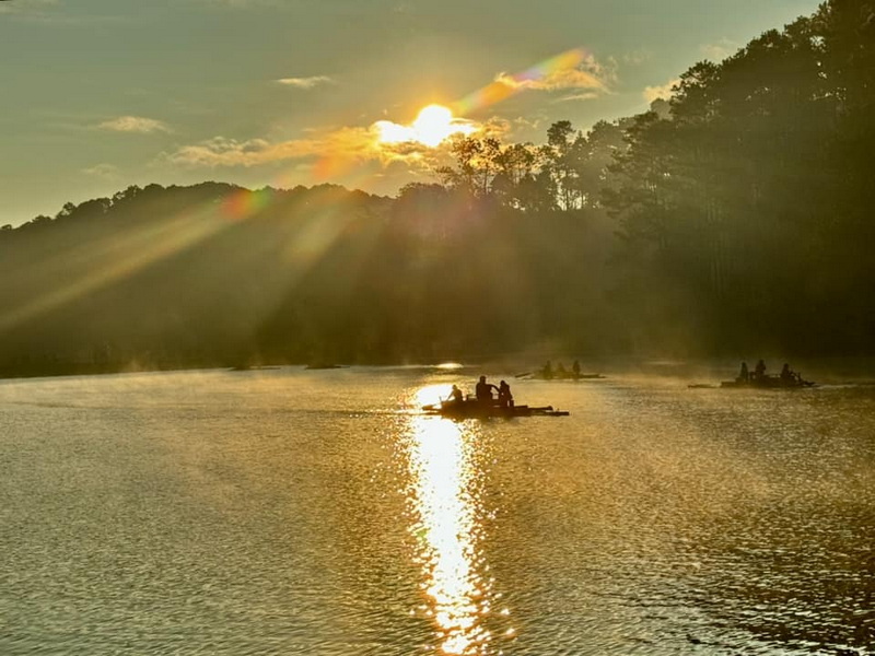
Road distances in the mountains can be misleading when judged only by kilometers. Curves, elevation changes, construction, rain, and pauses at viewpoints all affect the length of a travel day. Travelers who become uncomfortable on winding roads may prefer a slower schedule with fewer major stops. Independent visitors should also allow flexibility for daylight travel, navigation, fuel planning, and changing weather rather than assuming that an advertised route will feel the same in every season.
When evaluating a possible package or self-guided route, useful questions include: Is Pang Ung an overnight area or a short visit? Does the route begin in Chiang Mai or Mae Hong Son? Are Ban Rak Thai and Phu Klon included, or are they separate additions? Does the plan allow time for local communities and weather delays? These questions turn broad search wording into practical decisions without implying that any particular tour is currently available.
Two Regional Connections Beyond Pang Ung
Once the lake has been placed within its road and community setting, two nearby destinations help broaden the regional picture. They are different in character, so they work best as complementary possibilities rather than compulsory additions to every journey.
Ban Rak Thai
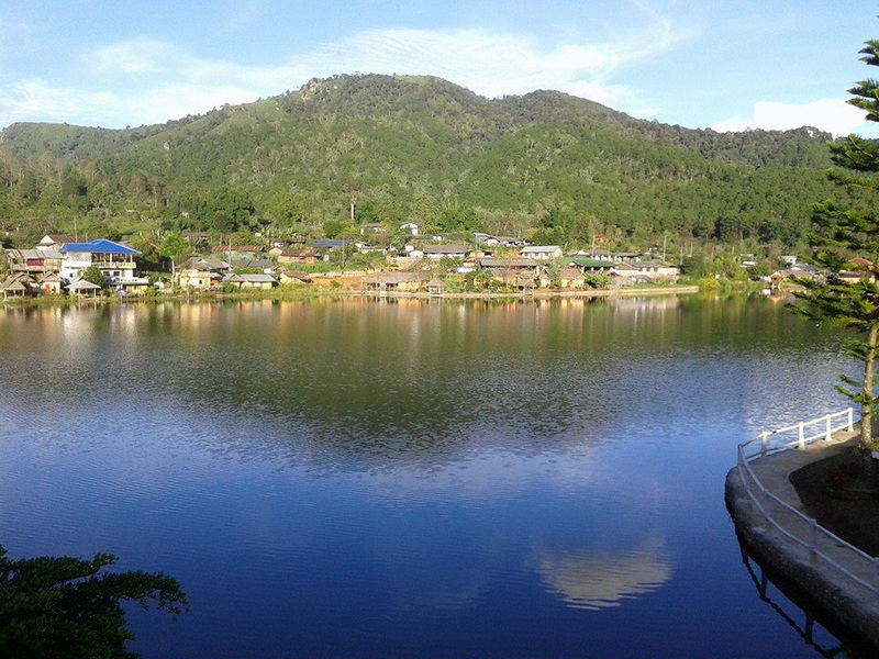
Ban Rak Thai adds a distinctive cultural and landscape dimension to a Pang Ung route. The settlement is known for its Chinese-influenced heritage, tea-growing environment, mountain setting, and lake-centered scenery. Its history and identity should be approached as part of a living community rather than reduced to a themed photo opportunity. Visitors can observe the relationship between houses, gardens, tea cultivation, food traditions, and the surrounding hills while allowing residents to set the boundaries of interaction.
As a route-planning choice, Ban Rak Thai can complement the quieter atmosphere of Pang Ung with a more settled village environment. The two places are often considered together because both sit in the same broader highland area, but they offer different kinds of observation. Travelers should allow enough time to move carefully between locations and should verify current road and access conditions. Buying locally made products where appropriate, avoiding intrusive photography, and following community rules are more useful than trying to hurry through every visible attraction.
Phu Klon
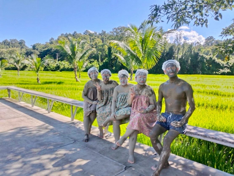
Phu Klon is associated with natural mud and mineral-rich ground in the Mae Hong Son area, giving a route from Pang Ung a different physical character. Instead of a forest lake, the setting introduces geological and wellness-related interest. Visitors should follow site guidance about where they may walk or touch natural materials, and they should avoid presenting health effects as medical facts. The attraction is best understood as a natural feature with local visitor uses, not as a substitute for professional treatment.
Including Phu Klon after a highland lake and village visit can create a varied regional itinerary. The contrast between water, forest, community landscapes, and mineral ground helps explain why route planning in Mae Hong Son often works better across several connected stops. Whether the site fits a particular journey depends on road conditions, opening arrangements, and available time, all of which should be checked close to travel.
Building a Regional Route Around the Lake
A sensible regional plan places Pang Ung within a sequence of experiences rather than treating every stop as interchangeable. The lake provides a quiet highland landscape and an opportunity to observe changing light, forest, and water. A nearby village visit can add cultural and agricultural context, while a natural wellness site or geological feature can change the rhythm of the day. This kind of progression helps travelers understand Mae Hong Son as a region with connected landscapes instead of a checklist of isolated viewpoints.
Timing should be shaped by the purpose of the visit. Early hours may offer cooler conditions and softer light over the water, while later hours can be more suitable for moving between communities and other sites. The area can feel very different during cool, dry periods, rainy weather, or warmer months. Rather than expecting one universally ideal season, travelers should match their plans to road conditions, visibility, and tolerance for changing temperatures.
A Pang Oung Lake visit also benefits from restrained expectations. Mist may not appear every morning, and reflections can be affected by wind or cloud. The appeal lies in the wider atmosphere: forest margins, mountain air, quiet water, and the contrast between a managed reservoir and surrounding highland terrain. Travelers who allow time to observe instead of rushing from one viewpoint are more likely to appreciate the setting without placing unnecessary pressure on the community.
For an independent traveler, practical preparation includes offline map access, modest luggage, suitable footwear, a light jacket, drinking water, and cash for places where electronic payment may not be convenient. These are general precautions rather than guarantees about local facilities. It is also wise to confirm current access information locally, follow posted instructions, and avoid leaving waste behind. Responsible preparation supports both personal confidence and the long-term character of the destination.
Planning the Journey with Place in Mind
Pang Ung is most rewarding when approached as part of Mae Hong Son’s highland geography and community life. Understanding the phrase Chiang Mai To Mae Hong Son Tour Package can help with research, but the actual route, travel pace, and local conditions still require careful checking. Pairing the lake with Ban Rak Thai or Phu Klon may add useful regional context, provided the schedule remains realistic and respectful. With flexible planning, considerate behavior, and attention to mountain-road conditions, a journey to Pang Ung can feel connected to the wider landscape rather than separated from it.

No comments:
Post a Comment